This Storm Just Got Worse…
Summary
TLDRThe United States, particularly the Central and Southern Plains, is bracing for one of the worst storms of 2024, with a high risk of long-track and strong tornadoes. The Storm Prediction Center has warned of severe weather, particularly for Kansas and Oklahoma, where a tornado outbreak is imminent. The forecast highlights a significant hail threat, with the potential for hailstones the size of grapefruits, and damaging winds that could reach up to 80 mph in some areas. The severe weather is expected to peak in the afternoon and continue into the evening, with a shift towards a line of storms producing further hazards later at night. The weather patterns, influenced by a negatively tilted trough and strong low-pressure systems, suggest a potent storm system that will weaken by Tuesday but could lead to another significant severe weather outbreak on Wednesday. Residents are advised to stay vigilant, prepare for the storm, and have multiple ways to receive weather alerts.
Takeaways
- ⚠️ One of the worst storms of 2024 is approaching the United States, posing a significant threat for long-track and strong tornadoes across the Central and Southern Plains.
- 🌪 The Storm Prediction Center has mentioned that a high risk for severe weather could be issued for parts of Kansas and Oklahoma, with an imminent tornado outbreak.
- 📢 Residents in the affected areas should have a tornado action plan in place and multiple ways to receive alerts.
- 🌡️ The risk includes not only tornadoes but also damaging winds and hail, with the potential for hailstones the size of grapefruits.
- 🚗 It is advised to protect vehicles from hail and not to leave them outside, as the storms could produce significant hail.
- 🌦️ The storms are expected to be discrete, meaning only a few at a time, but those that do form are likely to produce severe weather.
- 📍 The greatest tornado threat is expected from northern Kansas to far Northern Texas, including areas near Wichita Falls.
- 🌃 Later in the evening, the storm threat will shift towards damaging winds and large hail, with the potential for tornadoes continuing into the night after sunset.
- 📈 The significant tornado parameter values are expected to increase as the day progresses, particularly in the afternoon across Kansas and Oklahoma.
- 📅 For the following days, the severe weather threat is anticipated to decrease on Tuesday but may rise again on Wednesday with another potential severe weather outbreak.
- 🔔 Staying subscribed to the channel and having multiple alert systems in place is crucial for receiving timely weather updates and alerts.
Q & A
What type of severe weather is expected across the Central and Southern Plains?
-A significant threat for long track and strong tornadoes is expected, with a high risk for severe weather including damaging winds and hail.
Which states are at the highest risk for tornadoes according to the Storm Prediction Center?
-Kansas and Oklahoma are at the highest risk for tornadoes, with a potential high risk for severe weather to be issued.
What is the greatest concern for the day in terms of weather?
-The greatest concern is the hail threat, with a forecasted maximum hailstone size of grapefruits, indicating the need for vehicle protection.
What should residents do to prepare for the severe weather?
-Residents should have a tornado action plan in place, multiple ways to receive alerts, and ensure they have flashlights and mobile devices ready in case of power loss.
What is the expected timeline for the storms and tornadoes?
-Storms are expected to start around noon, with the tornado risk increasing by 2 to 3 PM. The most significant tornado threat is anticipated for the late afternoon into the evening hours.
What is the role of the jet stream in the development of severe weather?
-The jet stream, with a negatively tilted trough, creates a lot of spin throughout the atmosphere, particularly in the mid to upper levels, contributing to the severe weather and tornado potential.
How does the weather forecast change as we go into Tuesday?
-The severe weather threat is expected to weaken and broaden out, with the Midwest seeing less severe weather and a lower threat of tornadoes but some damaging winds.
What is the potential for severe weather on Wednesday?
-Wednesday could see another significant severe weather outbreak, potentially similar or worse than Tuesday, with a heightened tornado threat in the late afternoon through the evening.
What are 'discrete storms' and why are they concerning?
-Discrete storms are individual storms that are not part of a larger storm system. They are concerning because they can produce severe weather, including significant tornadoes, large hail, and damaging winds.
What is the significance of the atmospheric spin in the forecast?
-The atmospheric spin, or 'twirl,' indicates a higher tornado risk because it suggests there is a lot of rotation in the atmosphere that can contribute to tornado formation.
How can people stay informed about the severe weather and receive alerts?
-People can stay informed by subscribing to the YouTube channel for live updates, having mobile devices and weather radios ready, and being vigilant with multiple ways to receive alerts.
Outlines
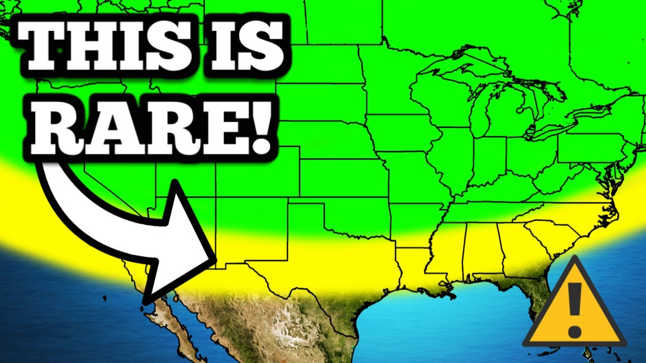
🌪️ Severe Weather and Tornado Threat for Central and Southern Plains
The video script discusses an impending severe storm system in the United States for the year 2024, with a high risk of long-track and strong tornadoes expected across the Central and Southern Plains. The Storm Prediction Center warns of a potential tornado outbreak, particularly in regions of Kansas and Oklahoma. The forecast emphasizes the need for a tornado action plan and multiple alert reception methods. A moderate risk for severe weather is already present in Oklahoma and Southern Kansas, with an enhanced risk stretching from Southeastern Nebraska to Western Missouri and Northern Texas. The script also highlights a significant hail threat, with a 10% chance of hailstones larger than 2 inches in diameter, and advises protecting vehicles from potential damage. The tornado threat is particularly noted from Northern Kansas to far Northern Texas, including areas near Wichita Falls. The forecast outlines a transition to a line of storms later in the evening, posing a significant damaging wind threat across Kansas and Western Missouri, with winds potentially reaching 80 mph. The synoptic setup, including a negatively tilted trough and strong southerly pole, is expected to contribute to the severe weather. The video promises live updates and alerts on YouTube, urging viewers to subscribe for the latest information.
⏱️ Timing and Development of Storms with Tornado and Hail Threats
The second paragraph delves into the timing and progression of the severe weather events. It begins by noting that storms may initiate around the Nebraska and Kansas border, with large hail and damaging winds as primary concerns. As the afternoon progresses, particularly around 2 to 3 PM, the risk of tornadoes is expected to escalate. The video channel plans to go live during this period to provide updates. By 4 to 5 PM, storms are predicted to grow向东 (to the east), with discrete supercells posing the most significant threat for long-track and strong tornadoes, particularly in western parts of Kansas and central Oklahoma. The paragraph advises viewers to stay vigilant, especially in central Oklahoma where discrete cells could produce tornadoes despite not being highlighted on future radar. By 10 to 11 PM, the storms are anticipated to continue moving eastward, and by midnight, they should still be active across Oklahoma with a lingering risk of hail, wind, and tornadoes. The guidance suggests that most storms will transition to damaging wind producers by the early hours, with a possibility of more tornadoes across Southern Iowa, Missouri, and Northwest Arkansas. The video concludes with a reminder to subscribe for live updates and a like for the content, and it briefly touches upon the potential for another round of severe weather the following afternoon across the Ohio Valley, with large hail and damaging winds but a lower tornado threat compared to the current day.
Mindmap
Keywords
💡Storms
💡Tornadoes
💡Severe Weather
💡Storm Prediction Center
💡Hail
💡Jet Stream
💡Tornado Action Plan
💡Synoptic Setup
💡Damage Potential
💡Alerts
💡Vigilance
Highlights
One of the worst storms of 2024 is approaching the United States, bringing a significant threat for long-track and strong tornadoes across the Central and Southern Plains.
The Storm Prediction Center has mentioned a high risk for severe weather, which could be issued later today for the tornado threat across parts of Kansas and Oklahoma.
A tornado action plan should be in place for residents in at-risk areas, with multiple ways to receive alerts.
An enhanced risk for severe weather extends from Southeastern Nebraska to Western Missouri and as far north as parts of Texas.
Significant hail, larger than golf balls and up to the size of grapefruits, is forecasted, posing a risk to vehicles and property.
Discrete storms are expected to be few but potentially severe, including the possibility of significant tornadoes, large hail, and damaging winds.
The tornado threat is particularly high from northern Kansas to far Northern Texas, including areas near Wichita Falls.
After sunset, a line of storms is expected to produce damaging winds, large hail, and possibly more tornadoes across the central plains.
A negatively tilted trough in the jet stream is contributing to the severe weather, with a strong southerly pole and increased atmospheric spin.
The severe weather threat is expected to decrease by Tuesday as the trough weakens, but another outbreak may occur on Wednesday.
The tornado parameter values are increasing, indicating a higher risk for tornadoes, especially in the afternoon across Kansas and Oklahoma.
By 12:00, storms with the potential for large hail and damaging winds may begin near the Nebraska and Kansas border.
Around 2 to 3:00 PM, the tornado risk is expected to increase, with live updates provided on the YouTube channel.
From 4 to 5:00 PM, the storms are anticipated to evolve and move eastward, with a focus on areas in western and central Kansas for severe weather.
By 10 to 11:00 PM, storms will continue eastward, with a hail and wind threat, and a potential for tornadoes in Oklahoma.
After midnight, the storms are expected to weaken but still pose a threat for damaging winds and tornadoes across Southern Iowa, Missouri, and Arkansas.
On Wednesday, there is a concern for a more significant tornado threat, particularly in the late afternoon and evening across Arkansas, Illinois, eastern Missouri, and Kentucky.
Subscribers to the YouTube channel will receive live updates and alerts for the severe weather events.
Transcripts
one of the worst storms of 2024 is
coming to the United States today and
this could bring a significant threat
for long track and strong tornadoes
across the Central and Southern Plains
where a tornado outbreak is imminent the
Storm Prediction Center has mentioned
that a high risk for severe weather
could be issued later today for the
tornado threat across parts of Kansas
and Oklahoma so in today's forecast
we're going to break down exactly what
this means for your area and where the
greatest chance for tornadoes will be
and as well as the damaging wind and
hail risk that are not being talked
about enough so let's begin with what
the risk is for today across the United
States and we're going to begin with the
Great Plains that is where we do already
have a moderate risk for severe weather
which includes a large chunk of Oklahoma
back into Southern Kansas where the
chance for strong and longrack tornadoes
will exist you need to make sure that
you have a tornado action plan in place
today have multiple ways to receive
alerts and we will be live later today
here on YouTube so make sure that you're
subscribed to the channel outside of
this area we do have an enhanced risk
that goes from Southeastern parts of
Nebraska back into Western Missouri and
even back into very far Northern parts
of Texas and a slight and marginal
threat that go from South Dakota back
through Texas and as far east as
Illinois which the majority of storms at
hypen over here later tonight will be
damaging wind and maybe a couple tornado
producers so make sure that you're
staying Vigilant there so here is one of
the greatest concerns for today which is
going to be the hail threat we currently
do have a large area that we're watching
for significant hail this hatched area
does represent at least a 10% chance
within a 25m radius of significant hail
greater than 2 in in diameter the
maximum Hailstone size that I have
forecasted for today is the size of
grapefruits so make sure that you're
protecting your vehicle do not leave
that outside today it is not worth it
especially with How much hail that could
come out of some of these storms now the
good news about today for Oklahoma is
that these storms are going to be very
discret meaning only a couple of them or
maybe a few of them will be ongoing the
bad news is any of the storms that are
discreet are going to almost definitely
produce severe weather including
significant tornadoes very large hail
and as well as damaging winds the
tornado threat right now is hatched
anywhere from northern Kansas back into
even very far Northern Texas including
areas near witcha Falls where strong and
long track tornadoes will be a
possibility later this afternoon into
the evening hour so make sure that
you're staying very Vigilant and being
weather aware then later tonight this
will turn into mostly a line of storms
producing damaging winds large hail and
maybe even a few more tornadoes across a
large chunk of the central plains any of
this will mostly happen after sunset for
the damaging wind threat that could be
very significant across Kansas and even
back into Western Missouri where
damaging winds as high as 80 mph will be
a possibilities with all that being said
make sure that you are subscribed to the
channel We'll Be Live later today
that'll be one way that you can receive
alerts in addition to that make sure you
have your mobile device handy any
weather radio's ready have flashlights
on hand in case you do lose power later
today as things could get a little bit
bumpy as we go into the afternoon hours
before we go into the timing I do want
to go over the synoptic setup for this
event as we go into today and tomorrow
because I think it paints a perfect
picture for what we're going to be
seeing for both today and tomorrow in
terms of severe weather so let's begin
with the jet stream this gives us an
idea of the weather patterns that are
happening across the United States and
we are going to have a negatively tilted
trough for today and as well as going
into early tomorrow which is why we're
going to see a big increase in terms of
severe weather you might be wondering
what does a negatively tilted trough
even do essentially what it does is it
creates a lot of spin throughout the
atmosphere especially in the mid topper
levels in addition to that we get a
strong southerly pole and any negatively
tilted trough usually does bring some
sort of severe weather aspect in a lot
of cases we do see severe weather
outbreaks that's why this is so
important for today and even into early
tomorrow morning so just keep that in
mind uh once again it is a very potent
trough and it's going to be a very
strong low pressure system the good news
is is as we go into Tuesday this will
weaken and broaden out meaning that the
Midwest will not see a whole lot of
severe weather it should be a pretty low
threat with just some damaging winds
back over in areas like the Ohio Valley
and maybe even down into the Mississippi
Valley we could see some severe weather
but the overall concern is going to be
pretty much lower than what we're
talking about today and then once we
eventually go into Wednesday we are
going to have a low pressure system near
the surface develop again in the central
plains and I do think on Wednesday we
are going to have another significant in
severe weather outbreak it could be very
similar if not maybe even a bit worse
than what we are talking about for today
but obviously that is to be determined
depending on how today goes it might be
a little bit different here are the
photographs as well giving you an idea
of about the spin across the atmosphere
from the low levels all the way up into
the upper atmosphere and notice these
photographs across parts of Southern
Kansas and Oklahoma there's a lot of
twirl to them a lot of Spin and what
that means is that we are going to have
a lot of spin in the atmosphere meaning
that that tornado risk is going to be
much more elevated because of all the
spin in the atmosphere it will not take
much for there to be a tornado today
especially with how strong the winds are
across the entire atmosphere from the
surface all the way back through the
upper level so that's why that's also
very important and then the significant
tornado parameter values do increase as
we go into the afternoon especially
across Kansas and they'll start to
increase in Oklahoma as we get closer to
4 to 5:00 notice those values go upwards
of five six and even seven in some spots
so it's going to get very elevated
across Oklahoma meaning that this
tornado risk is really going to start to
ramp up now I don't want you to look too
far down to the South because the cap
will be in place across most of Texas
and even right along the Red River and
there might be one or two storms that
sneak in there try to pose a threat in
Oklahoma in terms of severe weather
threat but I think overall that chance
is very low I think the majority of the
storms that fire up today will be from
Nebraska back into parts of Oklahoma
this should be the starting point for
most storms and then eventually they'll
start to track to the east maybe even a
bit further back here to the West we
could get a couple storms earlier in the
day today now let's go through the
timing and we will begin with 12:00
where a few storms will start to fire up
right across the Nebraska and Kansas
border where the main concern is going
to be large hail and damaging winds but
as we get closer to 2 to 3:00 I do think
that tornado risk begins to increase
with this activity so we might be live
as early as 2 to 3:00 so make sure that
you're subscribe to the channel and
click the Bell icon down below so you're
notified when we do go live once we get
closer to 4 to 5:00 those storms
continue to evolve and move to the east
producing mostly a damaging wind threat
but once again anything that is a little
bit more semi discreet could produce a
tornado threat and also anything even
embedded in this cluster of storms
will'll also have the chance to produce
a couple of tornadoes once we get closer
to 6 7 and 8:00 tonight we'll be
watching a couple of different areas for
discret supercells which are the ones
that are going to produce the most
significant longrack and strong tornado
threat across anywhere in Oklahoma and
Kansas and that would be where we're
watching for that development right here
in western parts of Kansas which again
that could be anywhere in this area for
the record not just that Circle that I
drew before and also even part across
parts of Central Kansas back over right
in front of the line of storms this
another area that I would be watching
for very very closely and then once we
get closer to 7 8 9:00 those storms
continue to move East and we'll continue
to watch multiple storms across parts of
Oklahoma producing the tornado threat
now don't really ignore this area I know
it doesn't show any storms on the future
radar but there is a chance that we
could see one or two discret cells even
in parts of central Oklahoma that
produce a strong Andor long trck tornado
threat so don't rule out that area make
sure you're staying Vigilant and have
multiple ways to receive alerts by
around 10 to 11 o'clock tonight those
storms continue to move Eastbound And by
midnight most of the storms are still
ongoing across parts of Oklahoma with
mostly a hail wind and maybe a couple
tornadoes still being possible and then
after midnight most of these storms are
damaging wind producers with a couple
more tornadoes being possible across
Southern Iowa parts of Missouri and even
Northwest Arkansas and perhaps even into
Eastern okoklahoma
so stay very weather aware across those
areas and again we'll be live tonight so
make sure that you're subscrib to the
channel back over in Iowa and Illinois
we'll have that line of storms moving
through early tomorrow morning which
will produce the threat for damaging
winds and perhaps maybe a brief tornado
or two it will weaken as we go late into
the morning but we're going to have
another explosion of thunderstorms
tomorrow afternoon across parts of the
Ohio Valley overall I think this threat
of severe weather is going to be pretty
low to medium I don't think we're going
to have anything too too significant
when it comes to the tornado threat but
I do think large hail damaging winds and
a few tornadoes will be possible I just
don't think it's going to be nearly as
significant as today I would still stay
weather aware in case anything does get
a little bit dicey we'll probably also
be live tomorrow so make sure that
you're subscribed to the channel now as
we go into Wednesday I think things do
become a little bit more concerning in
terms of the tornado threat notice the
significant tornado parameter values as
we go into Wednesday afternoon and
evening they get quite High across parts
of Arkansas Illinois eastern Missouri
and even back into Kentucky and I do
think we are going to get a more
significant tornado threat as we go into
Wednesday in the late afternoon through
the evening and perhaps even into the
overnight hours where we could end up
seeing a nocturnal tornado threat so uh
again details on this still remain a
little bit uncertain so stay tuned we'll
have another update video for this once
we get closer and once things do become
a bit more certain if we do not have an
update video we'll be live on Tuesday
with an update for you more than likely
so just make sure you're subscribe to
the channel and we'll keep you posted
with the latest thank you so much for
watching make sure hit the like button
down below and subscribe if you've not
already
5.0 / 5 (0 votes)

This Is Going To Cause WEIRD Weather…

A Serious Weather Pattern Change Is Coming…
Extreme Geomagnetic Storm To Impact Earth TONIGHT...

We’re About To Get Rocked By These Big Storms…

These Next Storms Look Even Bigger…
An Extreme G4 Solar Storm Train, Eight Storms Race to Earth | Space Weather Spotlight 10 May 2024